Photo Adventures with Curiosity and Learning
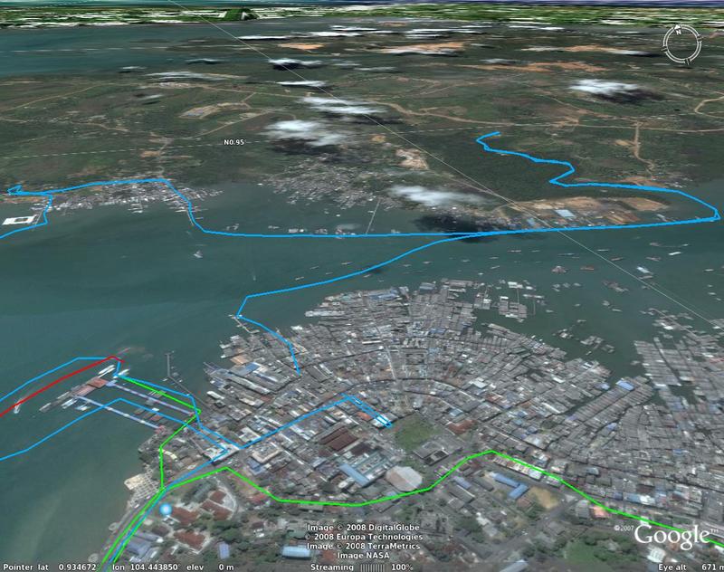
With Ellen and Sharon leading the way - we took the Penguin ferry to Tanjung Pinang, not to be confused with Sharon's home town (Penang). Below are the GPS tracks for out trip - to the east of Batam in the morning and west of Batam in the evening. About a 2 hour ride each way.
- GPS resoruces
- for the Bintan KMZ file Click to display in Google Earth
- GPS track file (feb_16_2008_bintan.gpx)
GPS Visualizer provides some neat tools for converting from GPS file formats to Google Earth / Maps format. Here is a presentation with Google Maps. The map is interactive and you can click and drag and magnify to see the correspondance between the GPS tracks and Google's satellite imagery.
- Somthine about the colors
- Cyan is the route from Tanah Merah to Bintan around the east of Batam.
- Green is our boat up the Snake river and around Tanjung Pinang.
- Blue is our taxi ride around Pinang and up to the tallest hill
- Red is the return trip around the southern and western boundry of Batam.
- Magenta is SBS Bus 35 from Tanah Merah Ferry Terminal to Tanah Merah MRT
The blue line is from Tanah Merah Ferry Terminal to Tanjung Pinang via the direct route - south east to Bintan. The red line is from Tanjung Pinang to TM Ferry Terminal by the scenic route - south of Batam to the east and then up to Singapore and North east to Tanah Merah.

A Google Earth view of our track up the Snake river and ships in the bay

A view of the Bintan mountain - where I took the panorama (near the bottom of this page)

THe photos of the trip: - leaving Singapore, and ships everywhere

Passing a ferry returning from the north coast of Bintan, a weekend get-away place for many Singaporeans.

Indonesian coast guard

A large ship and a small ferry boat

Entering the bay - a ship

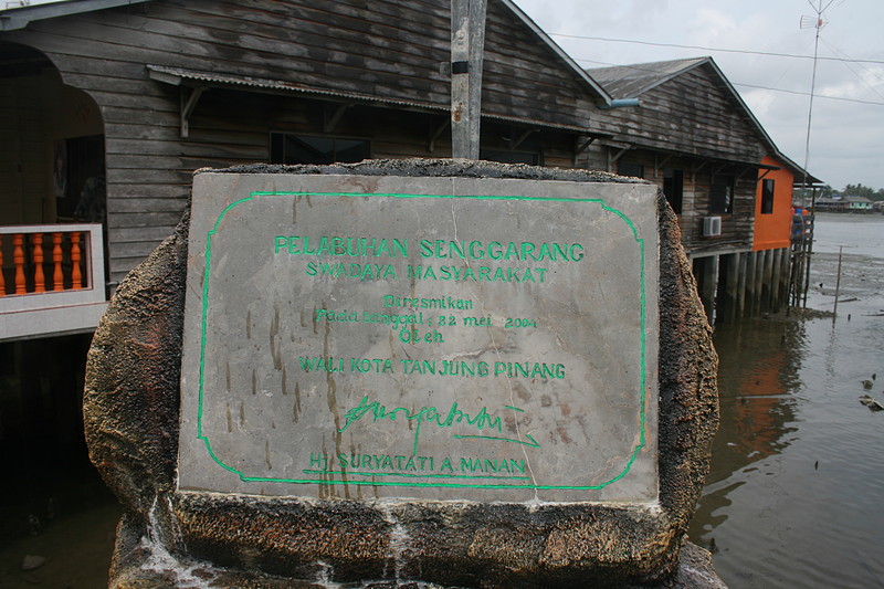
Here is Bintan

Leaving the ferry terminal and walking out to the main street. It is clean - as spelled: CLEAN.

We picked up our return ferry tickets then went for lunch. Edy, our guide and organizer picked very nice place for a typical Indonesian lunch. The main idea is no menu. The restuarant team brings you a tray of different dishes. You choose the one's you want and that is how you are charged. An alley on the way to lunch

Here is our lunch with the plate-based menu.

After lunch we headed to another dock where Edy had organized a small boat for us - and here is Rainbow row

Our ride from the Bintan dock into the bay, up the snake river, then back to China town, then to the island (Bentang?) and then back to Bintan.
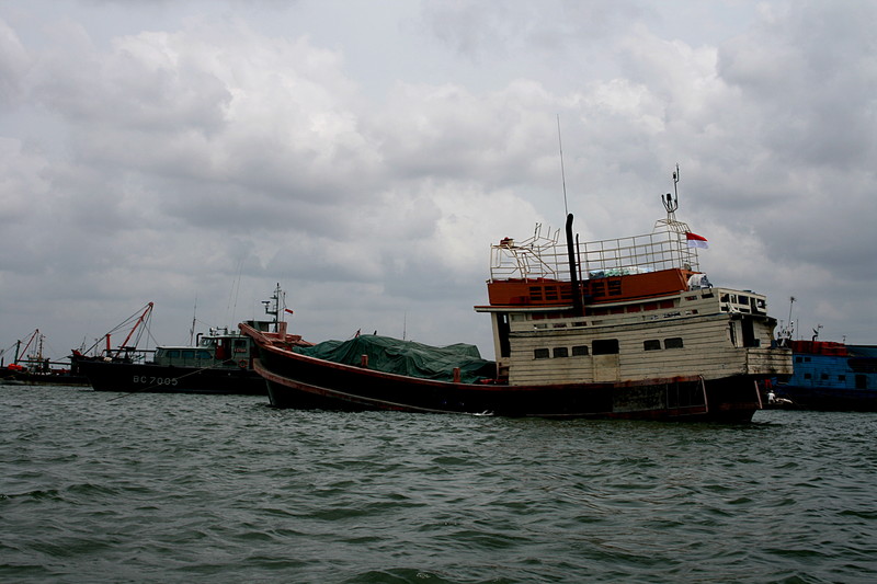
We enterer what I call Bintan Bay. Filled with ships, boats, micro ferrys, you name it - its there

A cargo something
And multi modes of travel

The hill where I took the panorama photos (near the bottom of this page)

An interesting ship

And a ferry boat
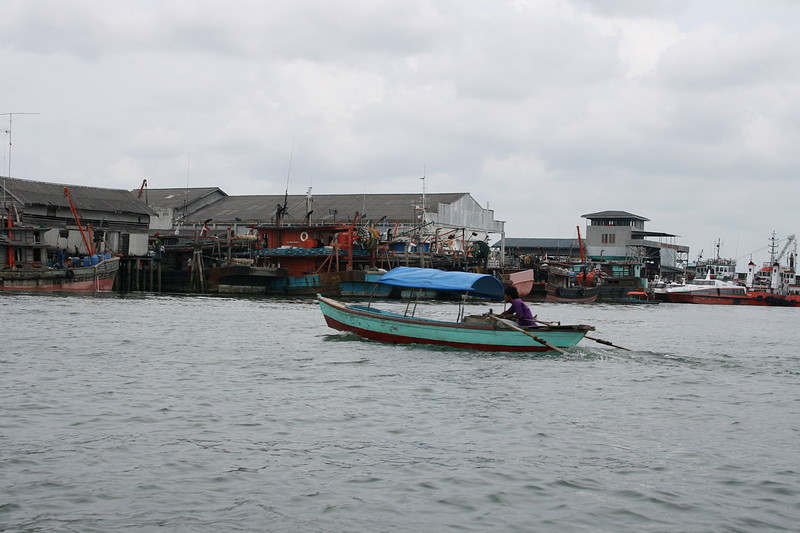
with a friendly wave

As we moved up the snake river, we passed a beach home - of sorts

From the other side

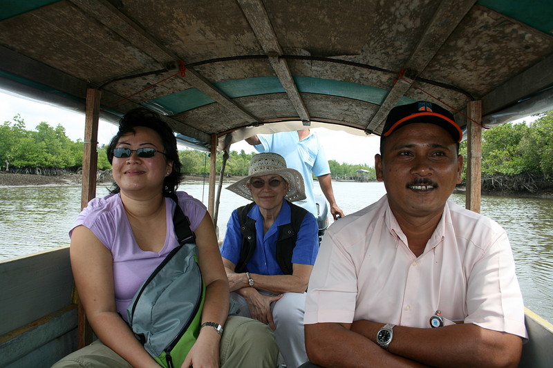
Here is Sharon, Ellen and Edy
These guys had a water problem -

And an empty tree

A crab with a red claw

A black crab

The Chinese Temple after the crab place

These painting show Chinese hell - I was told. The punishment for whatever

More paintings

The inside

from another angle

and a small room to the right


Crabs with curious eyes wide open

Edy took us back to Bintan bay - and we passed more boats
Boats at the dock

The vege man

A Thai vessel - captured

Next - we docked and walked through China town
A bit of reconstruction

A bean and shops

Then passed mini-Venice, at low tide

This was a very interesting temple - built under part of a Banyon tree

Another view

Happy New Year and prosperity, in my best Mandarin

A Chinese temple

With a happy man

And the ladies of prosperity

Brought to you by the local Ferry company

More statues

with many hands

And a group of guys

The signs of the zodiac - starting with the rat

And back to Bintan Bay - at least that is what I call it. From here we went to Penyengat Island, a small island to the west.

We passed a fisherman

And passed under clouds

Our island tour with a next visit to Penyengat Island. Up the hill to the cannon park with cannons at the ready and made in 1842.

Looking north across Penyengat Island toward Batan

The harbor

A Malaysian style cemetary

Looking at Ellen

Ellen and her chariot

Overlooking the approaches

1842 - the date the cannon was cast

Another canon with the date stamp

Another cannon

And another

The park sign - with Texaco present - May 2001, Pulau Penyengat

Our chariots

Stopping for a cool drink

A young girl and father working on homework

The end of the day

Rainbow row at the harbor

Walking out to our boat for the ride back to the main Bintan

Returning to the main part of Bintan, Edy organized a ride around the island as well as a side trip to the top

And here is Bintan panorama from the top of the hill

There was a small restaurant at the top with a clear view of Bintan and surrounding areas. Here are some scenes

The bay - with homes built on stilts with concrete walkways

A looking to the side

These four photos were stitched using Hugin, an open source photo stitcher, to create the panorama

Looking north west - toward the ferry terminal and channel. In the distance is Batam

To the left with Bintan mountain in the background

To the right - in the background is the island with the cannon park on the top

Our team

and Bintan panorama

This work is licensed under a Creative Commons License.
C. Frank Starmer